


That’s right! We’re delving back into Maps!
Right now, I SHOULD be packing up my house because I need to be out of it by Monday, which is offensively soon.
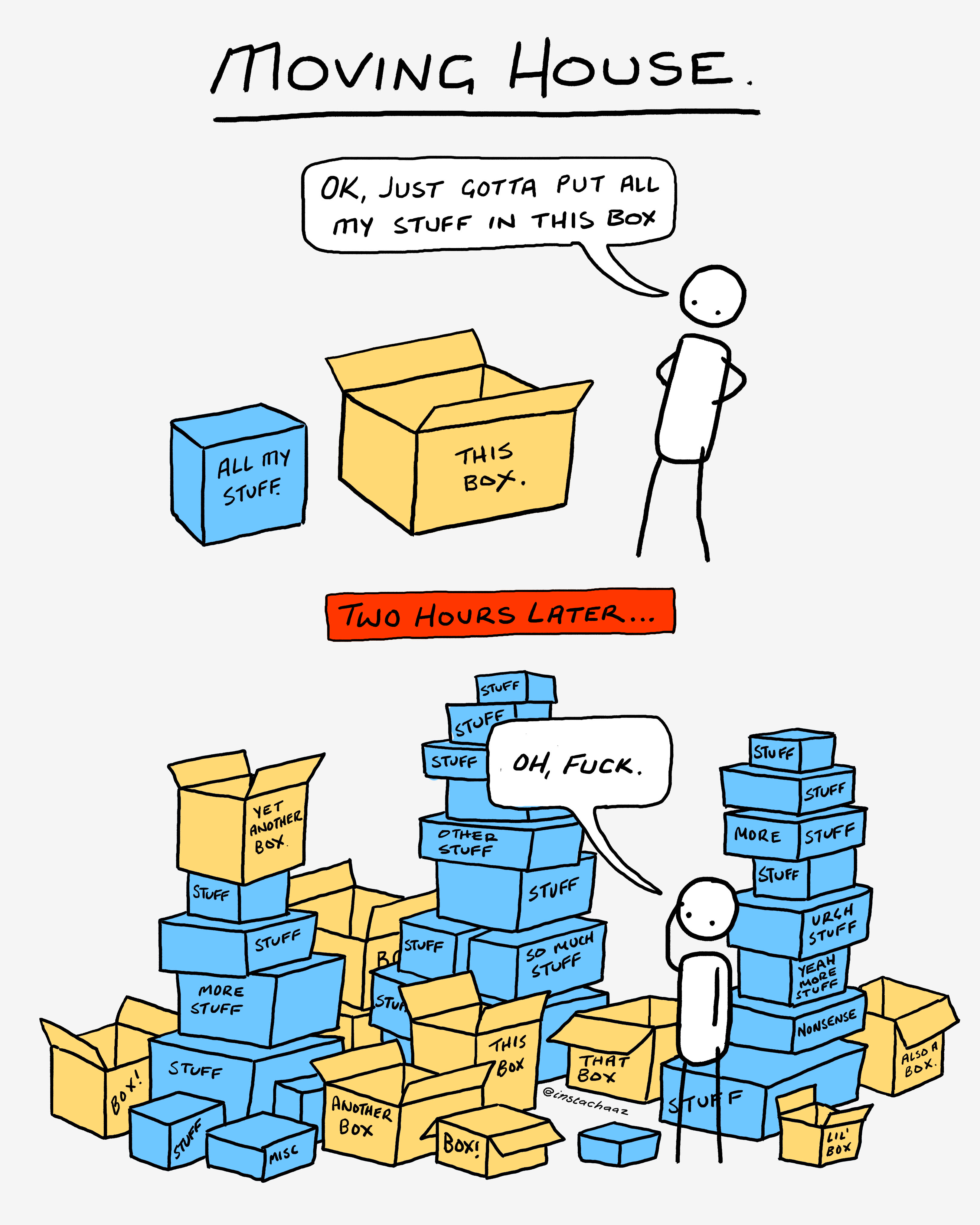
This would normally be fine, however my packing process currently looks something like this…
…but in my case, ALL the boxes are half full and have their contents strewn everywhere…
Where am I off to you ask?
BASICALLY NOWHERE!
The new place is just a 10-minute walk away, (the idea of walking everything over bit-by-bit has occurred to me). Given there are four flights of stairs in the new place, this would essentially constitute a kind of cross-fit session, but one that actually serves a purpose.
However - back to what I came to talk about!
MAPS!
It’s been a while since I’ve done a map special and now that I’ve recently started drawing custom maps, (more on that later) - I figured I’d dip back into them.
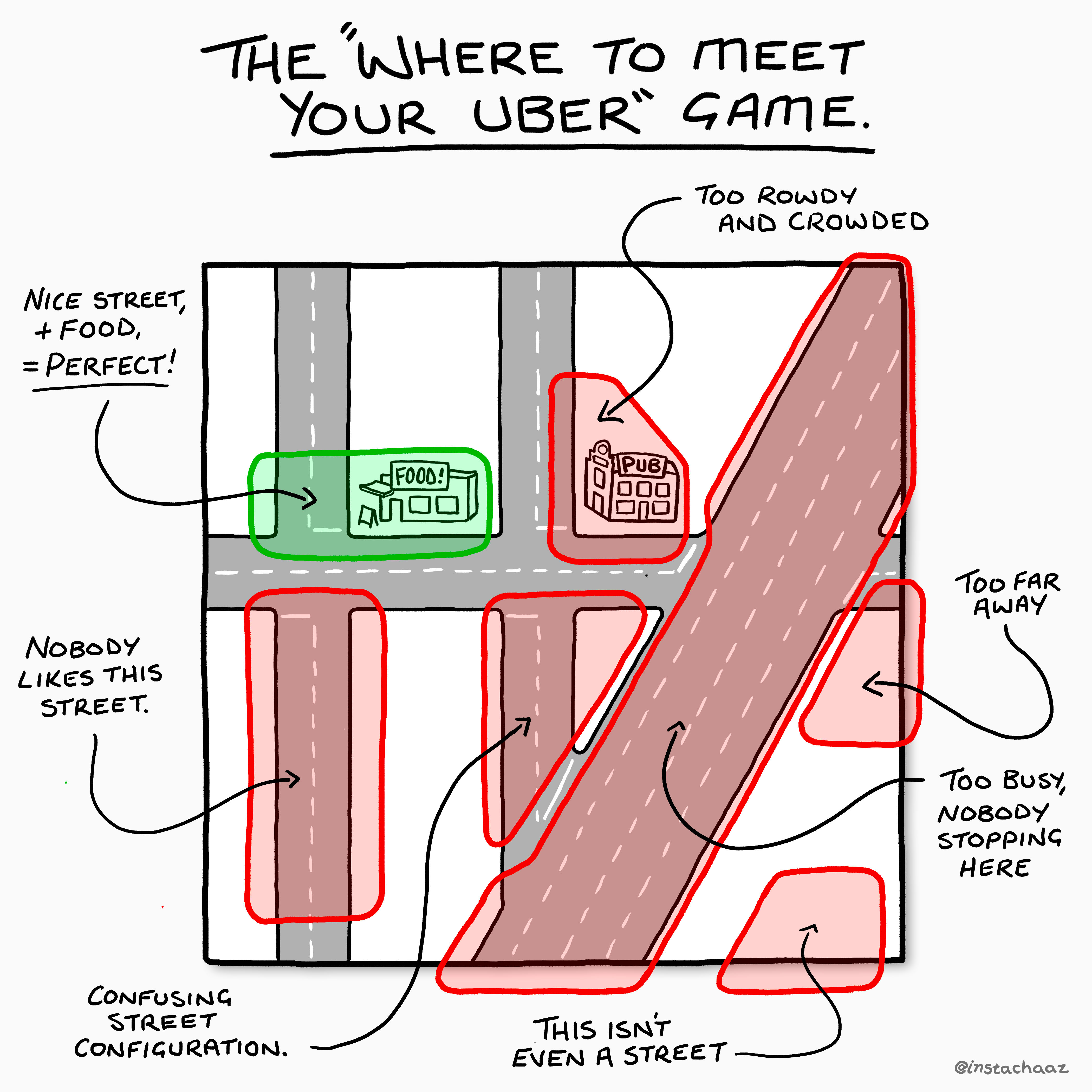
First up this week is a little map I drew for Uber UK.
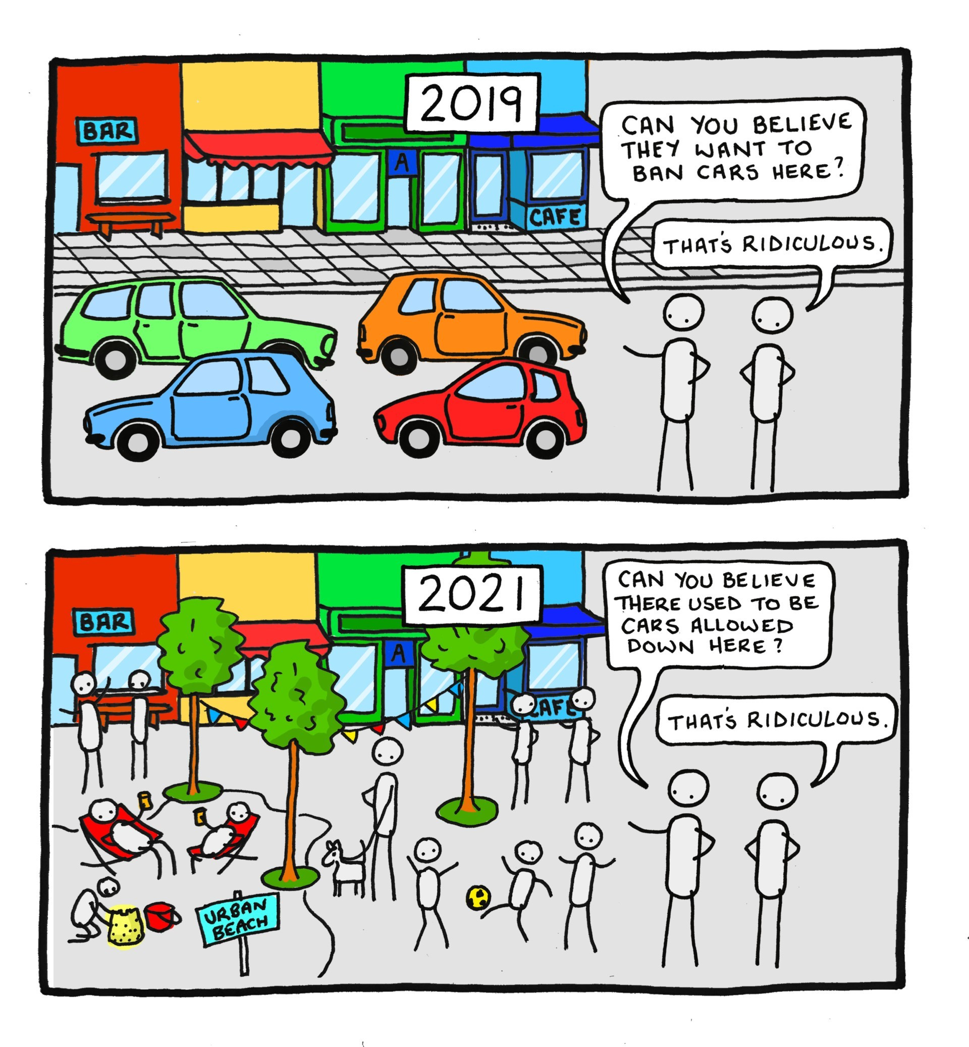
This next one is BARELY map-worthy, but I’m going with it anyway! There’s been a lot of talk in the news lately about pedestrianising Oxford Street, (something that seems to happen every few years).
While it’s the obvious thing to do for that street, the idea that more tourists would then be able to fit in there is a horrifying thought to any Londoner, who is likely to avoid it even more than they already were. (which is to say, somehow go there a negative number of times?)
As always, there’s the passionately aggrieved group of anti-pedestrianisation people who always seem hyper-fixated on delivery vehicles and taxis. To them, I’d say that if a bunch of those weird American candy stores have to close down because their candy truck can’t get in, it might not be the end of the world.
Here’s my take on Pedestrianisation in an article for Atmos some time ago…
However, let’s get on to the fun stuff!
(I wanted to put more map stuff in, but I’ve got a house to pack folks!)
I’ve recently started getting back into drawing maps!
Years ago, I made a map of London for my friends Pav and Gal, (Well, Pav and Gal’s specific corner or London anyway!)
Drawing this at the time was a lot of fun, and (ridiculously) back then I also did this all by hand!
During my chaotic pack-up, I even found my little grid guide that I slipped in behind my page to maintain a consistent angle and sizing of each building! - How quaint!
These days, I’m a little more technologically advanced, and so the task is now significantly faster! Which is why I’ve decided to BRING BACK the maps and offer up some Custom Made Maps - just in time for Christmas Gift Buying Season!
(it really is the perfect gift for the I-never-know-what-do-get-them Person)
Of COURSE, for all you lovely Outlined subscribers I’ve included a little thank you discount! - and not just for maps, but EVERYTHING!
Just hit that button, or put in OUTLINED-01 at the checkout! - The offer is only available this week, So be sure to get on to that!
Looking forward to drawing some of your local towns and cities!
Other Stuff.
For those waiting for Part 3 of the Exhibition saga, that’ll be coming next week once I’ve dragged my entire life a few blocks away.
If you missed the first two installments, you can find them here: Part One and Part Two.
Also! BIG NEWS ALERT! I’m talking at TEDx Mitte next month! (I know right?! whaaat?) - but I’ll pull together a more detailed post all about it, because it does feel like a bigger deal than a note at the end of an email!
For now though, here’s the official speaker announcement! Woo!


You can check out the rest of the event here.
And That’s It!
So, don’t forget to jump on that discount, and give this thing a share or leave a comment (LOVE the comments!) and I’ll see you all next week from the new flat!